October 26 and 27 Elizabeth City to Deep Point to Slade Creek 43 5 and 33 NM Respectively

From Eliz. City we got a late, 11 A.M. start, due to marketing.  It was mostly motoring but we put up the genoa three times for about half of the passage, once even turning off the motor. We arrived at the anchorage after the sun had set, but before it got dark. Our route was to continue down the Pasquotank River, traverse Albemarle Sound and go south (up) the Alligator River to a place off Deep Point which is deep enough to anchor, moderately protected from potential winds, outside the ICW channel and reachable before dark. The little white space to the left of the word "River" in the upper right quadrant of this chart segment hit the spot. It is 2/3 of a mile long and about 700 feet wide at its widest spot.
There are about 8 boats here. We are in 11 feet of water with 60 feet of chain out. We have a potential problem because when we tried to use reverse gear to set the anchor, we heard only strange sounds. So we laid out sixty feet of chain, which, with the weight of the anchor, held us in place all night in very gentle air. If we had dragged, there was a lot of room behind us toward the channel in which the anchor, hopefully would have caught. No internet access here. Dinner, card games (Lene almost always wins), reading and in the morning we emptied the aft compartment so I could take a look at the "no reverse gear" problem. I saw how, by disconnecting the end of the cable from the shift lever at the helm, one could manually shift the boat at the engine itself. And while we had access, I added distilled water to those of the cells of the batteries that looked like they could use a few sips.
Among the boats here were "Whisper," who we met in Elizabeth City, and their buddy boat "Piper."
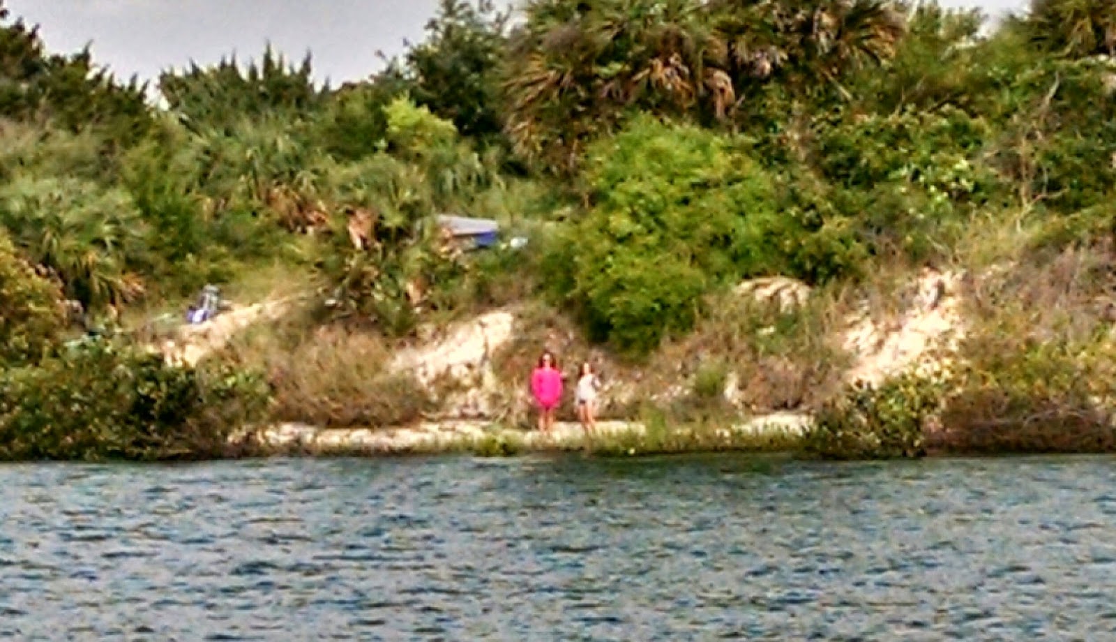
In fact, two of the three adorable kids who played with Witty belong to Piper, not Whisper. We accompanied them most of the next day, toward Slade Creek through the Alligator-Pungo Canal and somewhat down the Pungo River, but they had elected to go elsewhere the second day.
The AP canal is quite a bit wider and almost twice as deep as the Great Dismal Swamp Canal.
Our only scary moment was crossing under the Wilkerson Bridge, near its southern end; unlike all the other fixed bridges over the ICW, which are 65 feet high, this one got short changed and is only 64 feet high -- and we are 63.5 feet high!
Slade Creek is wide and over a mile long. We got here first, at about 2:30 after a totally motoring day, and anchored in the first bend after entry, where the wind protection was good, in eight feet of water and were later joined by two other boats. There is lots of room here.

Then chores: I dove into the brownish, tannin dyed water and cut several lengths of line from around our propeller, but the boat still makes a chattering noise in reverse. We will get this checked out in Oriental, our next stop. (Also the harvesting of leaves in the Great Dismal Swamp Canal whacked our wind speed and direction instruments making them even more in need of calibration.)  I went up the mast to reattach the halyard for the Harlem Yacht Club burgee because the halyard had worn through in the strong winds in Yorktown, completed the wiring of our two million candlepower flashlight for finding buoys at night, hung a picture, fixed a cabinet and organized our cabinets. This last in the course of looking for the two white LED interior lights that we replaced with red ones to preserve night vision. Lene does not like living in a red light district. But we have not found the white ones yet.
The problem here is flies, lots of them. Lene killed about a hundred that had invaded ILENE. She is fully screened but they got in while we were underway and the companionway was open.
Also Alphie gave Lene a scare. She was missing, Lene was crying. I looked in both the aft end and the forward end of the stack pack tube that holds our mainsail when it is not in use. No Alphie. Finally I unzipped the top of the tube to raise this sail and there she was, in the middle, perturbed that her nap disturbed.
Read More..

April 17 19 Redbird Creek to Beaufort SC and Two Lay Days There 66 5 Miles

We hauled the anchor at 7:15 to get to Hell Gate about 30 to 60 minutes before high tide at 8:40, measured at a tide station only 2.5 miles from that canal. It was cold and windy -- in the wrong direction -- but we passed through Hell Gate with no less than nine feet of depth -- about six more than would have been there at low tide. We got such an early start and partial favorable tides, that we changed our destination from Bull Creek to Beaufort SC, which had been scheduled as the next days destination; we got onto a mooring, rather than their dock where we had stayed our last two times here at 5:05 pm.  Generally the tides were running to the sea from high tide near Hell Gate for six hours and then rushed upstream. The course was so circuitous and involved going upstream on some rivers and down on others that it was always a surprise to us when we entered a new segment to find out which way the tide was flowing. With 2500 rpms on the Yanmar our speed varied from 4.8 to 8.4 knots depending on the current. Maybe some Comp Sci Ph.D. could solve the riddle of when is the best time to leave from point A to go to Point B, depending on your boats speed, unadjusted for tide, and the date in the lunar cycle. But I cant game nature. I mentioned hairpin curves and here is an early part of the passage
from the pliers at the right, through Hell Gate  at the screwdriver tip, upper right, past one hairpin curve above the big washer to just above the wrench jaw at the left. Overall,  the course for this segment was about 30 degrees, or north of northeast.
The portion of the days passage before we got to and crossed the Savannah River was new to us. It took us past Thunderbolt, the boating capital of Georgia. We had heard so much about this place, so close to Savannah, including that the marina brings you a free Krispy Kreme doughnut in the morning. Here are its boatyard and marina and a big beauty. I wonder how she got in this far from the sea with her mast vastly exceeding 65 feet in height.


We also passed Paris Island and Hilton Head, both of which I mentioned during our voyage south last fall.  We tried to motor sail in the afternoon, when we got to Port Royal Sound and the Beaufort River the last 14 miles, but the wind had died down and our speed brought it to our nose.
Our stay in Beaufort was quiet. Unlike our last two visits here, we took one of the marinas moorings. We used the marinas courtesy car to spend $290 at the Publix on Ladies Island, across the river. We off loaded several days of our garbage, filled our four one gallon water bottles, met with friends, including a pot luck dinner ashore. We had planned only one lay day, but the forecast weather seemed worse on the second lay day and we like it here so we stayed.
We made a date with Carla, co-owner of another Saga 43, "Reverie", as she was driving past this town between Charleston and Brunswick. But she had a friend as a passenger who did not want to stop, so our rendezvous had to be put off until the fall when, hopefully, Carla and John, who we have not yet met in person, will be driving through New York on a day when we will be there.
We spent some time discussing whether to divide the segment from Beaufort to Charleston into two halves, as we did on the trip south, but in the end decided to go almost all the way to Charleston and anchor in the Stono River, just south of the city. This solution avoids two problems. 1. It is hard to find a berth in Charleston due to Race Week. 2.  There is a strong tide under a bridge that is closed for rush hours which we have to pass at the end of another long day, just before Charleston.
We saw a matinee of Noel Cowards "Blithe Spirit", at the USC Beaufort campus theater. We sat next to Louise and Jim, nice folks, who recommended "Narrow Dog to Indian River" by Terry Darlington, which I am recommending to Dick and Elle.
Though in a university setting, the show was put on by the local theater group and funny, a farce: during a seance with a medium a mans wife comes back as a ghost visible only to him and torments his new wife. And only $20 per ticket for good seats.
And having had dinner and breakfast at Low Country Produce, located in the former City Hall, during our trip south, we had lunch there this time. Innovative inexpensive food in a place with cloth napkins  which also retails its food; one sits among display cases and racks.
The dink is hauled and we have to get underway early tomorrow to make the 7 am opening of the Ladies Island Bridge, less than a quarter mile away, or wait until 9:00.
Read More..

November 13 and 14 Charleston to Tom Point Creek to Beaufort SC 60 6 Miles


Charleston is like New York in at least one way: both were started at the confluence of two rivers, and the point of juncture is a park and called The Battery.
It is surrounded by lovely stately old homes.  But you cant sail by close because a sand spit extends out from the point.

A pretty easy day of it, 9:45 to 3 pm, motoring all the way in the ICW, which was wide and deep. Cold but not unpleasantly. We made a connection with the boat next to us in the Charleston Marina, "Kachina", a Hans Christian 33, with the most beautifully treated teak.
It is sailed by John and Joanna currently from Colorado but originally from Canada and Marthas Vineyard, respectively. We exchanged cell numbers and stayed close to them all day. We had originally selected Steamboat Creek for the midway anchorage to Beaufort, but Lene read about Tom Point Creek after it was recommended by Jim of "Goldie,"
a home made, steel, blue schooner. So the Admiral changed our destination. The two creeks are only about a mile apart.
The only obstacle today was one low bridge that opens every half hour from 9 to 3:30, only about 4.5 miles from the marina. We left when we were ready and the marina had sent a man to help a boat come in, so he stayed and helped us get off. But it was too late for the 10 am opening so we went very slow for the first 4.5 miles and got there in time for the 10:30 opening and still had time to get through Elliot Cut before its very swift tidal flow turned against us at 11:15.  After anchoring,  I lowered the dink and used it as a platform to get some rust stains out and polished some stainless, before being chased inside by the cold. A cold front with stronger winds passed during the period midnight to 2AM, but our anchor held.

Where is Tom Point Creek, you asked? Oh, it flows into the Wadmalaw River. It runs between Stann and Little Britton Islands. Still no help? Well you wont find Tom Point Creek in Google, except for information on the tides there, but it is about 20 feet deep and just wide enough for a single column of boats to anchor, and swing with the tidal change; a strong tidal current runs through it, For the curious, look in Google Earth at 32 degrees, 38.75 minutes North; 80 degrees, 16.86 minutes West.  It is bordered by salt marshes on both sides
and the book said -- and correctly so -- that dolphins swim up the creek, playful looking but looking for food.


In the morning all six of us had mango pancakes before setting off at about 9:30.
Joanne and Jim

Jim and Susan
Both John and Jim are very handy, the former a carpenter and boat builder, the latter a mechanic who built Goldie and who has lived aboard for 40 years. Both are professional delivery captains so they know something about sailing, in fact, a lot!
When we pulled the hook I did the math: with the Ladies Island Bridge, near Beaufort, closed from 4 to 6 and it being dark by six, we needed speed to get to that Bridge, from which is less than 1/4 mile more to the Downtown Marina of Beaufort. We supplemented the engines power with the small jib and trimmed it on every point of sail during the twisting ICW to gain an extra knot or two. We slowed down only in the three "Cuts" between different rivers. The cuts were short but reported to be shallow, though no problem for us today. A passing shrimp boat, its wings out, surrounded by its posse:
 We made the 3 pm opening, with the grace of the kindly bridge tender. The hundred cars and trucks lined up waiting until 3:06 when we passed, may not have thought of her so kindly, though. I think it was Lenes feminine voice that prevailed upon her to wait for us.

We plan to be on docks, here and in Hilton Head, for several days, using dock power to provide heat until the polar vortex goes away.


Read More..

April 4 Titusville to Rockhouse Creek New Smyrna 31 2 Miles

Well the good news is that apparently felines have short memories. So Witty is not a permanent victim of Post Traumatic Stress Disorder, but his old pesky self. It was Saturday, the day before Easter, and warm and sunny so EVERYONE was out on the water. We saw hundreds of boats from Stand Up Paddleboards, to kayaks and canoes,


to fishing boats of all sizes,
to what I call motorized rafts.
And people were wading and swimming in the ICW too.

I put out the genoa and later the small jib but the wind was too close to our bow much of the time and too erratic. Anchor to anchor from 9:30 to 3:00. Only two opening bridges, one on request and the other every twenty minutes, which we made easily. The tide helped us the last third of our passage, except the last mile, once we got to Ponce de Leon Inlet, and we turned down the engine to near idle speed to give the watermaker two hours to make water before we arrived. We passed some nice modest waterfront houses
and some waterfront trailer parks also known as fishing camps....I think.

Rockhouse Creek runs east-west, connecting two  N-S waterways. (It is the horizontal in an "H".) When we arrived it was very crowded with perhaps fifty small boats and a few large ones. Folks had gone to the beach. We can only enter from the ICW, western end because it gets too shallow for us at the other end, but many powerboat people think that circumnavigating the unnamed island that forms its south side is a nice trip. We heard five of them comment on ILENEs name as they passed us. We had dropped anchor and settled in and by six p.m. there were only three boats left (one other sail and a trawler)
and we were too close to the sailboat, especially because there was so much room everywhere else and strong winds from the east were expected. So we picked up and dropped 150 feet further away from that sailboat. Our other neighbors were a family of campers.
There was no one on the other side of us, where we would turn right and be back in the ICW.

Im having trouble with the new snubber hook, (as well as the underline function) specifically in getting it to stay hooked onto the anchor chain; it falls off and dangles uselessly under the boat instead of doing its job. I tried tying it on but this wasnt working well so I next tried wrapping one side of the hook with rubbery tape to narrow the slot into which the chain sits, but that fell off. 
Here in Rockhouse, I knew it had fallen off when the wind came up at night: the chain took the load instead of the snubber and when ILENE hunted from side to side, the anchor chain snaps over in the bow roller making a sound like the boat is being pounded by a sledge hammer.

I created a way to mount the red and green dinghy navigation light using a suction cup, a piece of scrap plexiglass, a nut, some washers and a piece of thin line.

We have been noticing that Florida has given nicknames to its geography much as in Manhattan, neighborhoods like SOHO and Tribeca that have no legal or governmental significance  are used to define neighborhoods. The southern part of Florida: Miami, Fort Lauderdale and maybe Boca is called the Gold Coast. Heading north, next comes the Treasure Coast including Palm Springs, Stuart and Fort Pierce, so named because Spanish treasure galleons sank off this part of Florida. Cocoa, Titusville and New Smyrna are called the Space Coast. I hadnt noticed this before.


Read More..

May 6 7 Herring Creek MD to Fairview Beach VA to Washington DC 41 7 and 38 8 Miles

We got underway from herring at 6:40 to avoid low tide a few hours later. There was no wind to speak of. Rivers often provide poor wind though last nights interval of 35 knot gusts cant be denied. So while we had our sails up both days, they gave us only a few tenths and only briefly; it was a motoring day.

We heard what sounded like explosions. I thought it might be coming from our boat but Lene reassured me it was far away, like last nights thunder. Then came a voice: "Sailboat heading north on the Potomac off Cobb Island, this is Range Boat 4." I acknowledged and he asked me to switch to channel 12 which I did. He asked if we had paper or electronic charts and I said "Both". He said they were conducting naval gunnery exercises and the deep wide channel in the center of the river is where the shells would be landing. He asked me to check my charts and pointed out five navigation aids that hug the Maryland shore.  I should thread our way to and through them. We complied cheerfully and while the water was a lot shallower than center channel, it was never less than 12 feet. We heard many explosions, seeming to come in pairs, about two seconds apart: the guns report and the shells explosion upon hitting or its fuse setting it off. This is the orange topped Range Boat One, at the other end of the range, who stopped a crab boat that did not have its radio on.


We passed this nuclear power plant, the smoke or steam rising from it telling the tale of the days wind.


We crossed under the Nice Memorial Bridge on which Route 138 runs.
Once again, with our early start,  we went further than originally planned. The guide books describe anchoring in the Port Tobacco River, which flows into the Potomac from Maryland. It is about four miles wide at its mouth and perhaps four miles deep to the village at its narrow end (approximately the dimensions and triangular shape of Hempstead Harbor in Long Island Sound), but most of it is considerably less than six feet deep though there are large areas on both sides near the mouth that are 7 to 9 feet deep, where we could anchor. With winds (though light) predicted from the South, there would be little protection in those areas. Lene discovered a broad underwater plain on the chart, about ten to eleven feet deep, on the Virginia side of the river, near what the chart described as Fairview Beach, about ten miles further upstream and far outside the channel. This likewise provided no protection from wind or waves -- except from the south.
This place was not listed as an anchorage by the cruising guides, but it was very advantageous in dividing the 80 miles to the District of Columbia into two nearly equal passages. The chart described the bottom as "s sh" meaning sand and shells, which is good for anchoring. I asked friendly Range Boat Four about it. He said he had used it so we did too, and the anchor held so well that we had to use ILENEs engine to break the anchors hold on the bottom once we got its chain tightly straight up; the windlass was not strong enough. We were the only boat anchored and had lots of swing room and potential drag room but the scattered thunderstorms missed us and we had a quiet night. The next day we left at 6:30 to catch favorable tide most of the way, making seven knots instead of four. Again, motoring, except when the engine stopped for a few minutes and I had to switch fuel tanks. We passed this strange and unmarked buoy farm on the Maryland side.


The Potomac is huge - long, broad and deep -
and much of its shorelines are  undeveloped though some nice houses are built on the bluffs overlooking both sides, including this old one -- Mt. Vernon -- George and Martha Washingtons house, to the left of the big white tent, about ten miles from DC.
Except for the crab boat and one other trawler heading south that we passed near the end of our two days, we saw no other boats except for small runabouts and an anchored derelict boat during our almost 80 miles combined, until we got within ten miles of the Nations Capital, where the waterway had ferry traffic.
The Woodrow Wilson Memorial Bridge, which our charts said was a "bascule bridge under construction", caused us some consternation when we first saw it from five miles downstream. Bascule bridges, after the French word for see-saw, are designed to be opened and from the distance it looked low, so we tried to call on channels 16, 9, and 13 to get an opening, but with no response. Lene then read that it requires a twelve hour advance notice for opening. Oh no! She got a telephone number and called. "Yes, but you are in luck, we are opening for maintenance at 11:30 tonight" was the response. Im saying to myself that this cannot be. We will be having a ten hour wait and then have to enter a new harbor in the dark!!  We were told that this new bridge has so much vehicular traffic that it opens only at night. Finally we learned that its vertical clearance, at the white part to the left, which does open, is 70 feet; it is a high bridge that ILENE can pass under without its opening. I had assumed, that all new bridges over major waterways would be at least 65 feet high and many low bascule bridges are being replaced with new high ones so it made no sense to build a low bridge in the 21st century. But it sure looked low from a distance.
We refueled and then docked at the Capital YC, which is under reconstruction, with a series of temporary walkways between the docks leading to its temporary clubhouse in a former motel. We are at the furthest end of the furthest dock, making for a long walk to get out or to the showers, but the most remote dock is a good place for the kitties to roam. We immediately found both the staff and the other boaters here to be quite friendly and helpful. Free coffee, a map with the directions to the supermarket, etc.
Our first afternoon I spent faxing and Fedexing a document to my daughters attorney in Vermont who is helping her sell the riding academy where she has lived and worked for over ten years We also provisioned at a nearby supermarket, washed the topsides and, after dinner aboard, watched a couple of hours of "Wolf Hall" via the Clubs wifi in the clubhouse.
I also contacted my friends, Bob and Maria, who invited us for dinner at their house on Saturday night. I have known them since I worked with Bob in 1970. We last saw at about this time of year in 2006 when they drove to Annapolis to meet up with us there. We are looking forward to spending several sightseeing days in this beautiful city.
Read More..

October 19 Mill Creek of Solomons Island to Mill Creek near Reedville 43 miles

From one quiet anchorage to another. We had planned to go to Reedville, a nice small town, formerly capital of the menhaden fishery. These small fish are used in fertilizer and cosmetics; in NY we call them bunker. A millionaires row of Victorian houses of the captains of the fishing boats is well maintained. On our first visit, in 2006, we dinked in, toured the town and were invited to the weekly Friday night pot luck gathering in progress at the Public Library, even though we had no "pot" (nor bottle) with us. But in checking "Skipper Bobs" we learned of another Mill Creek, on the opposite (southern) side of the entrance to the Great Wicomico River from Reedville. The chart said that the water in the marked channel was deep enough and many folks in Active Captain had praised it so we changed our plan and added another new port (Cambridge was the first this cruise) to our Chesapeake destinations.
For all except the out and in portions of the days trip the wind was about 160 degrees off our starboard bow plus or minus 20, and strong. The direction gave us the first chance to use the new preventer lines - the first time on this cruise that the wind was nearly behind us. The preventer prevents us from damaging ourselves and the boat in the event of an accidental jibe.  We did not have such a jibe today, only one very controlled jibe near the start, but its like carrying an umbrella to prevent rain.

We saw a lot of 20 knots, some 25 and a gust of 30!  And that is apparent wind so the true wind was five to ten miles stronger. The boat got to 10.5 knots during one long memorable surf down a wave. Our chart plotter has a logging feature which records our position every half hour and computes our course made good from one such fix to the next and the distance between them. Of course this is worthless if you make big loop and end up in the same place half an hour later, in which case it shows you went zero knots and zero distance. But today we were going relatively straight, with only a  few detours to avoid hazards. During the four hour period from  10:30 to 2:30, the computer says we covered 31.7 nautical miles, for an average speed of 7.925 knots. Not bad. One half hour period shows 4.5 knots! Well take it. I have a video of the knotmeter display, showing the speed shooting up and then back as we surfed down a wave, but not the 10.5 knot wave, and Ill have to add that video when I learn how to, because my computer says I cant due to no "previewer" installed. And another video shows a wave rushing up behind us and passing under us. If I was really good at this we could see the two on split screen, but Im not going for an advanced degree.


This was with small jib and reefed main.
The day was clear and bright but cold, as shown by the outer layer of Lenes attire.
She can handle the boat. During the beginning of the "going in" part, when we turned west and brought the wind forward of the beam, we discovered that we were overpowered and the boat tried to round up into shallow waters. Lene steered while I furled the headsail. She also made excellent suggestions as to a good location to turn directly into the wind to drop the main, and monitored iNavix on the Ipad while we went from buoy to buoy, in to the anchorage. We had a beep at seven feet when we got too close to the shallows that line the channel and I turned to safety.
Another delicious home cooked dinner.
Read More..

April 5 Rockhouse Creek New Smyrna to St Augustine 54 7 Miles

9:45 to 7:45 -- a long day, longer than planned. Our plan had been to go to the anchorage by Fort Matanzas on the Matanzas River, only 42.3 miles to break todays trip into two legs. The various sources we use: Skipper Bob, Doyle and Active Captain, have different ideas about how best to enter this anchorage. They all involve turning east into the Matanzas from the ICW but some are crowd sourced and some say to make the turn just south of green buoy 81A while others said to make the turn north of that buoy, and there is a discussion that the sands shift. We turned in just south and went from 12 feet of water to hitting the sandy bottom within 20 feet. Whump! Naturally, in such chancy circumstances we were going slow, as slow as the current in the ICW would allow. But if we had not been making some speed the current would have pushed us backward when we turned. We were able to back off in perhaps 15 seconds. But now we knew that we did not know how to get in there, though we saw another boat anchored within. So this episode took the bloom off the Matanzas anchorage rose and we motored the remaining miles 12.4 miles that we had planned to do the next day, to the Municipal Marinas mooring field in St. Augustine.

The waters were as vacant during this Easter Sunday passage as they had been crowded with people and boats the day before. This may have had something to do with the weather. It did not rain, but all day the meteorologists predicted rain and the skies looked like they were planning to let loose. It was reasonably warm until late afternoon. In the morning the winds were quite strong, gusting to 20 knots, so we flew the small jib while motoring and made more than seven knots. Later we made such speed when favored by the tide but only 4.8 knots when it flowed against us. Someones idea of an unusual waterside home:

It was a bit foggy, misty lets say,  toward the end, diminishing visibility of "the next buoy" which is our holy grail. This reminded me of how dependent I am on the most primitive navigation device we have: the human eye. But the mild fog in the mooring field is what permitted me to capture the loom of the Saint Augustine Lighthouse (one white flash every 30 seconds) at dusk.

We were visited buy a pack of four Porpoises, which swam against our boat on its mooring, probably seeking to eat seaweed growing on our hull, which reminds me she needs a cleaning.  Ilene believes they sensed our cats and wanted to make friends.

We plan to use our dink to run errands and for sightseeing tomorrow, and the launch, which only runs only once per two hours from 10 a.m to 6 p.m., on Tuesday and Wednesday, when the dink will be repaired. Weather permitting, we will sail, outside, to Cumberland Island by the St. Marys River on Thursday. less than 60 miles and ILENEs first sail since Miami to Fort Lauderdale.
Read More..

April 15 16 Jekyll to Walburg Creek to Redbird Creek 60 6 and 14 Miles Respectively

We got underway from Jekyll late relative to the tide, at 8:30, due to the need to fuel up. But the first  time we went aground it was solely my fault: Green on the right northbound in the ICW,... I just wasnt thinking. But no biggie; we backed off easily and quickly. The second time it was the fault of the lack of dredging in the ICW: we were in the center of the channel and while we were not stopped, the alarm was ringing and the fathometer said we had only five feet of water so we were dragging the bottom six inches of our keel through eight inches of very soft sediment. But after the first two miles of the days passage, depth was no longer a problem.
St. Simons Sound, gateway to the commercial city of Brunswick, is quite deep. And the tide flowing out, southeast, was favorable, very favorable, so we were motoring at over nine knots. Once clear of the channel we motor sailed during the morning but once the wind came up (a broad starboard reach) we sailed without motor in the afternoon toward St. Catherines Sound. A very pleasant sail under warm and sunny skies. Other than two shrimpers who were working St. Simons Inlet, and a sailboat we were catching up to off St. Catherines Sound, we saw no other boats. We even enjoyed good tide after the jibe, going west into St. Catherines Sound, making eight knots with just the main.
We had started with the plan to go to Wahoo Creek in the Sapelo Inlet. (Most inlets around here are named after the rivers that flow out of them and most are named for Saints: John, Mary, Catherine, Simon -- maybe it was from the period when Spain was influential here?) But while out there, we found that St. Catherines was only ten miles further and we had lots of time to get there before dark, so plan B went into effect.  Nearing arrival, we saw rain clouds gathering to the west, ahead. When we set our anchor in Walburg Creek a light rain had begun and while I was attaching the snubber and securing things it got torrential. Nothing to do when the boat was finally secure but take off all clothing -- everything was saturated -- towel off and put on fresh clothing before dinner.
Walburg Creek is bound by marshes on both sides and sparsely inhabited on land or by boat. We had a scare in the middle of the night when the tide had gone out and we showed only eight feet of water, rather than fourteen, and were dangerously close to the south shore. The wind had come up and the tide was flowing. I got Lene up and she started the engine. I pulled up the anchor, Lene moved us maybe 50 yards to a better spot (there was lots of room) we dropped and set it and, after watching, we went back to sleep. Lene, who edits these posts, criticized me for failing to express our sense of terror while picking up and re-anchoring in inky blackness with current flowing fast and wind howling. She is correct.
In the morning the plan had been to sail to Bull Creek, up in Tybee Roads, which is the entrance to the Savannah River, near Hilton Head. The outside route would have been 43.2 miles as compared to 48.9 via the hairpin turns of the ICW. But the wind was from the north at up to 20 knots and especially for the 20 mile plus outside part of the passage Lene was not enamored of beating into that stuff on a cold grey day with rain forecast. And I was not looking forward to it either. There is a saying to the effect that "Gentlemen do not beat." Beating into strong wind in the ocean beats up the boat and the boaters. So Plan B: inside. But blocking the way was Hell Gate. It is a portion of the ICW, a canal, only .6 miles long, connecting the Ogeechee and Vernon Rivers. But with our draft, we cannot get through except at very near high tide. And the tide was already flowing out and we had a couple more hours to go, so: Plan C: Redbird Creek is a totally uninhabited creek through the marshes and only 4 miles from Hell Gate. It was tricky in Redbird when the strong wind was blowing from the north while the tidal current ran the other way. ILENE did not know how to lie on her anchor. The good news is that the anchor held. No one came through by day or night; it was just us and the kitties. And very dark at night, being for from civilization. We arrived in the late morning with plans to leave in mid afternoon, but stayed the night. The views: N, S, E and W; are impressive for their blandness. At low tide one is six feet lower and sees less other than the banks which are closer.


Read More..


Blog Archive

Powered by Blogger.